The plan was to travel to Argentat and, with detours en route, other towns and villages. Like I said, that was the plan and it remained the plan for about an hour.
The first detour was to a place called Belvedere de Gratte-Bruyere. Shown on our maps to be a view-point. The satnag refused to acknowledge that any such place existed. Luckily I had already spotted a sign in the centre of Serandon and so off we set.
The weather was beautiful and sunny so driving down the ultra quiet French lanes was a pleasure. The sun shining through the over hanging branches creating dappled shadows. Down one such lane we were suddenly presented with a view of a typical Chateau. I would have loved to get a shot of the front but it was not accessible. So you’ll have to make do with a back view…

A short drive further on and we arrived at the Belvedere de Gratte-Bruyere which gives spectacular views along the “Haute Vallee de la Dordogne”.
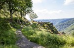
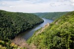

Standing up there was like being in an eagles eyrie, like you are on top of the world. Very, very quiet, but for the movement of the air through the trees and the ever-present twittering of the birds.
Beautiful !!!
Continuing on towards Argentat our route took us down alongside the Dordogne and, a short distance from the belvedere, we came across a large upright rock formation …
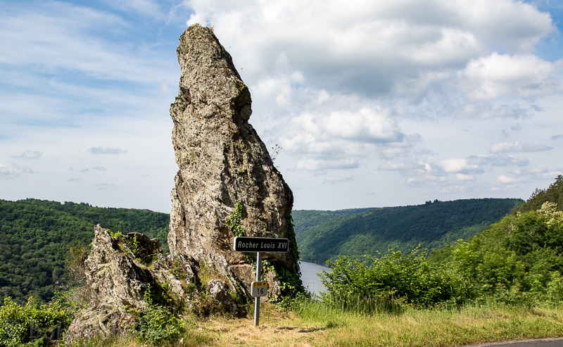
So far I have not been able to find anything about the significance of this rock.
Driving as slowly as we were, with the windows open, you become aware of the many streams noisily tumbling down the sides of the gorges. One was large enough to warrant its own pull in and picnic tables ….

Very pretty, with the dappled shadows from the trees. We met some ramblers here, their two dogs were very pleased to drink from these chilly waters.
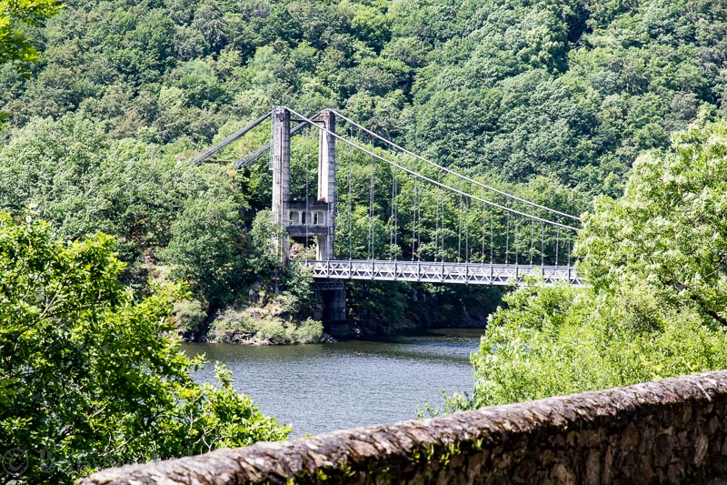
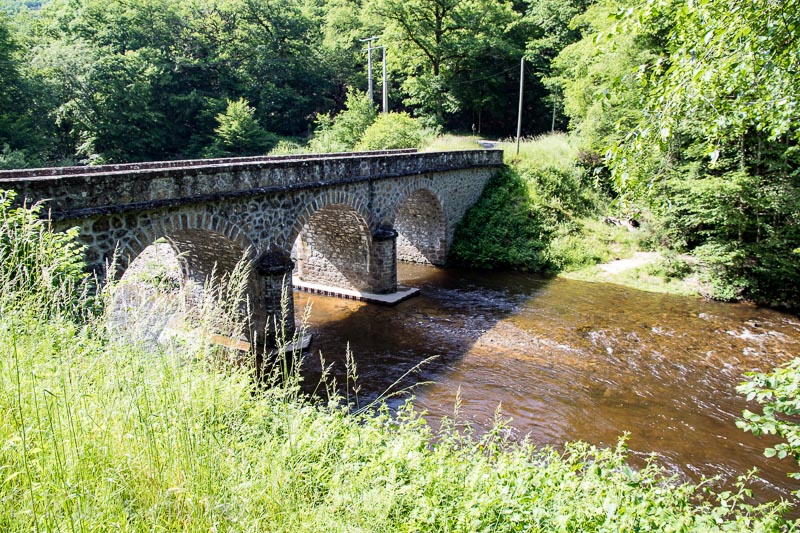
Having descended to the bottom of the gorge it was time to cross the Dordogne. The French Government had kindly placed a bridge at the end of the road, to ease our crossing ….

Although we were in the Dordogne Valley, the piece of water that this bridge crosses is in fact “La Triouzoune”.
According to Wikipedia “The Triouzoune is a 50.5 km long river in the Corrèze département, south-central France. Its source is on the Plateau de Millevaches”
Having crossed the bridge we were soon climbing up the sides of the gorge which continually presented photo opportunities along with chances for Gerry to show me how brave she is …..


Soon we were crossing the water again, this time the Dordogne via the “Pont Saint Projet”. A suspension bridge, which has a span of 195 meters and was built in 1945, following the creation of a dam some 5 km downstream from the bridge. More about the dam later.
Apparently, below the bridge, swallowed by the newly formed lake is the village of Saint-Projet-le-Desert and also the fifteenth century convent Saint-Projet.
Climbing, once again, we burst out of the gorge into open fields and farmland and soon found ourselves in the village of Chalvignac. Very pretty but, as we arrived, under attack from a large contingent of school children. You’ll be pleased to know that French school children can make just as much noise as school children everywhere. Quite a contrast from the tranquility we had just been experiencing down in the gorge.
A few kilometers down the road and we found ourselves on top of Le Barrage De L’Aigle (Eagle Dam), the reason that the village of Saint-Projet-le-Desert found itself under water.


Built between 1940 and 1945, the dam created a lake, 16 miles in length. Three villages, La Nau, St Projet and Nauzenac, situated on the banks of the river, were all drowned. In Nauzenac, two inhabitants, who didn’t want to leave their house, were drowned by an exceptional flood during the night of the 7th of December 1944.
Apparently, the formal name of the dam, originates from a rock situated downhill from the dam. Needless to say we did not spot the rock.
Alternatively, the dam is called “the dam of the Resistance”, because it was used as a refuge for the maquis.
Maquis (World War II) – Wikipedia, the free encyclopedia
The Maquis (French pronunciation: [maˈki]) were rural guerrilla bands of French Resistance fighters, called maquisards, during the Occupation of France in World War II.
Some workers were involved both in the maquis and in the construction of the dam. These “workers” employed delaying tactics to the works so that the dam couldn’t be of benefit to the Germans.
On the downstream side of the dam there is a park with information boards and picnic tables, nice of the authorities to provide such a beautiful vantage point from which to relax and enjoy the view.
On the road again we stopped for a quick photo looking back up the gorge, towards the dam, looking over the village of Aynes.

Pretty as the village is, I don’t think I could live so close below such a structure.
At the beginning of this post I said that our original plan was to visit Argentat. We had set out around 10:00 and by now it was after 14:00 and we started to think about lunch. Of course many country eateries close their kitchens for the afternoon, only opening again for the evening trade. And so we found ourselves in Saint-Privat at “La Belle Epoque”.
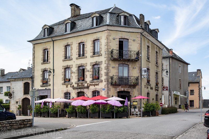
Due to our time of arrival,l we were informed that the kitchen was closed. However, they could still provide us with the “plat du jour”, which on the face of it sounded OK. A starter of Eggs Mayonnaise, a main of Sausage with cheesy mashed potatoes (so we thought) and a pudding of pannacotta.
The eggs mayonnaise were fine, not much to mess up there. The sausage and cheesy mash turned out to be sausage laid on a bed of cauliflower cheese with a sprinkling of fried mushroom slices. The oily juice from the mushroom frying was running around the edge of the cauliflower pile. It would have been OK if the sausage had been freshly cooked, but I suspect that it had been reheated in a microwave. Not an impressive meal. Gerry didn’t eat all of her main course and, of course, none of the panacotta. As it happens the panacotta was also OK.
I guess, as I previously mentioned, due to our timing, beggars can’t be choosers. Personally, I think I would have rather gone to a supermarket and bought bread and cheese. Lesson learnt, eat earlier or take a picnic.
We did, eventually, reach Argentat and very pretty it looks too. However, due to our meandering we didn’t feel we could do it justice and have earmarked it for a dedicated visit during the next two weeks.
As we were leaving Argentat we spotted this Chateau, which must have one of the most idyllic settings one could wish for.
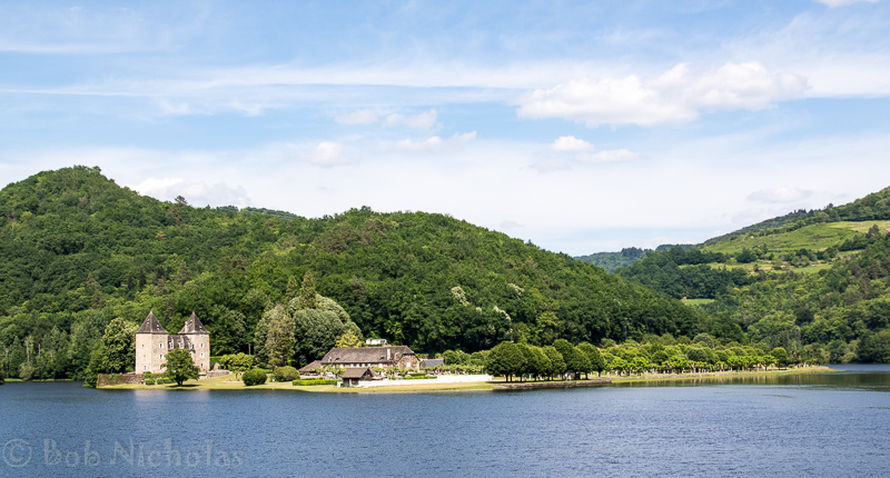
This place is now operating as a four star holiday site with provisions for camping, mobile homes or apartments.
Still travelling back towards the gite, our route took us through the village of Saint-Martin-la-Méanne whose church has an unusual tower.
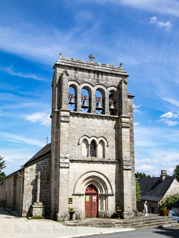
The village takes its name from its geographical position between two rivers, the Dordogne to the east, the Doustre to the west and a plateau of lakes and ponds in the North.One last photo from our grand tour. Not sure where it was but it needed to be recorded for posterity, whatever that is.
So, our day did not go as planned but turned out to be very pleasant. Even though the food at La Belle Epoque could have been so much better, it did not spoil the day. It was nice to be able to tour around on such quiet country roads, taking our time and stopping as and when the fancy took us.
It is the peaceful environment that attracts us to rural France. Long may it stay that way.

One thought on “Argentat”