Awoke in Geraldton to wet pavements and fairly heavy rain. Seemed just like home in the UK, except that the temperature was up in the twenties. First things first, we had a full cooked breakfast. The Ocean Centre Hotel has so much going for it, but the breakfast let it down. Soggy toast, tasteless scrambled eggs and poor service.
Car loaded up we set out for Carnarvon. After a while the rain stopped but it wasn’t to be the last time that we saw it. After about forty minutes of driving, we are heading up the Northwest Coastal Highway and soon approaching Northampton. Having been following a road train for some time, we were presented with a much-needed overtaking lane. So I hit the pedal and we were soon speeding past the leviathan of the road. Admittedly by the time I passed the truck I was probably doing approximately 120 -130 km, which is exactly when I spotted the dark vehicle parked at the side of the road. The one with the strange device facing out of the back window. No flash, no blue meanies on motor bikes like back home, in fact no indication that I had been nabbed. I’ll just have to wait and see if this turns into a ticket.
A general comment for driving in Australia but it is amazing how often the highways folks put in place an overtaking lane and just as you reach it they will reduce the speed limit from say 110 km down to 80 km !!! Especially when the overtaking lane is on a long incline. Does that make sense ?
We passed through Northampton which looked to be a pretty rural town. I made a mental note that we should stop and have a wander on our way back to Perth.
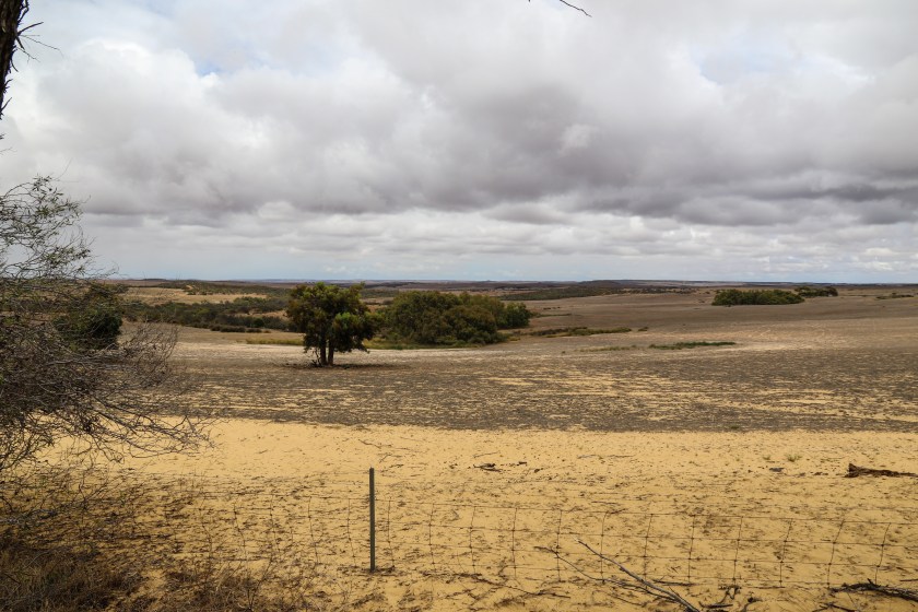
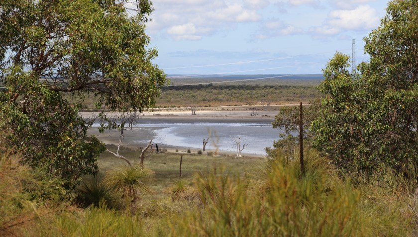
A few kilometers north of Northampton I stopped to take a photo of the never-ending countryside. According to the GPS on the camera we were near someplace called Alma.
On we traveled until we reached the Billabong Roadhouse some 180 km north of Northampton.

We topped up with fuel, made good use of the toilet facilities and stretched our legs at the roadhouse before continuing northwards.
Travelling along the North West Coastal Highway you begin to realise the name is something of a misnomer. Mile after mile of generally straight roads bounded on both side by sandy soil based bush might give one the feeling that you are driving over a very large beach but close to the coast ? Nope, I don’t think so.
If you look at a map of WA you will see that the road does run sort of parallel with the coast but in reality you are usually many kilometers away.
A few kilometers up the road from Billabong we topped a rise and I stopped to attempt to show how long and straight these roads are. These two photos show the north and south views of the North West Coastal Highway from a point near Carbla.


And so we moved on….. and eventually we made it to the 26th Parralel.

Now we were truly into the north of the state. The roads looked pretty much the same but the accompanying countryside had changed and soon we came upon signs for a lookout. We didn’t see any signs giving a name and there were no information boards explaining what you could see. Subsequent googling identified it as White Bluff or the Gladstone Lookout.


On top of this, very windy, flat-topped, hill we discovered a couple of “cairns” comprising all manner of memorial artefacts. Some were formal, cast iron, plaques. Most were just rocks that had been written or painted on. One of the “cairns” comprised various gnomes, dolls and other figures. White Bluff gives an almost 360 degree view over the Wooramel countryside. Showing the highway disappearing northwards and southwards, views across the plain and out to the sea at Shark Bay (I think).
descending, from White Bluff, we once again commenced our journey north. Pausing at the Wooramel Roadhouse to top up again with fuel. Shortly after leaving the roadhouse we crossed the Wooramel River ….

This picture doesn’t really show just how dry this land is. This river is actually just a sandy river bed. You get used to seeing signs on the road for such and such a river or so and so creek. Never seeing a drop of water or even mud in the little, narrow, gully passing under the road. However, the Wooramel River is quite a reasonable size. The pictures below show how wide and how dry.


After only another 115 kilometers we arrived in Carnarvon and checked into the Carnarvon Motel.

This foot bridge was once part of the railway line from town to the One Mile Jetty. It now provides a pleasant walkway along the same route.

The Fascine is a picturesque bay in Carnarvon. The boardwalk is apparently popular with the locals for walking and picnicking. It wasn’t very busy while we were there.

We had thought to freshen up and go into Carnarvon for dinner. It, the town, appeared to be closed so we returned to the motel and had dinner in their restaurant. Which, as it turned out, wasn’t bad at all.